
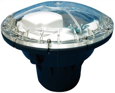
Buoy: SV-6000L type
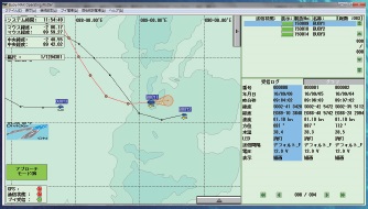
Ship station: Example of display of buoy and Schooling fish information on chart
Features
The satellite buoy (Marinestar) is a new positioning and tracking system that pinpoints the buoy’s location on electronic nautical charts, thereby improving fishing efficiency.
The buoy’s position and movement history are displayed on the nautical chart. In addition to direction, the buoy’s speed and surface water temperature are also displayed, allowing this data to be used as information on ocean currents.
Furthermore, since the speed and direction of fishing vessels are displayed on the chart in real time, it is easy to determine the estimated time of arrival (ETA) at the buoy.
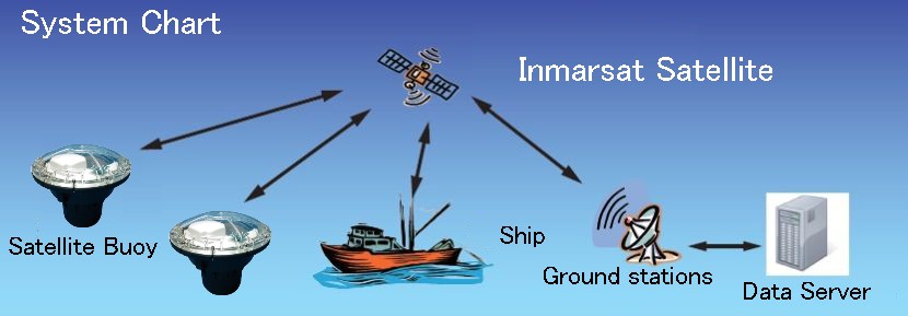
This communication system utilizes IT equipment that leverages Inmarsat satellite communications and the Internet.
It is equipped with an environmentally friendly solar power system, enabling continuous operation without worrying about battery levels.
Its operational coverage spans nearly all major ocean regions worldwide, including the Pacific, Atlantic, and Indian Oceans.
Composition Equipment
| Buoy | SV-6000L model Satellite buoy |
|---|---|
| Ship station | SV-SC5000 model complete set (PC, buoy management chart with software) |
By utilizing satellite communication for transmission and reception, reliable retrieval of buoy information is ensured.
Information from the buoy and operation commands from the ship station are transmitted via: Inmarsat satellite → Earth station → Inmarsat satellite.
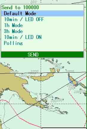
The frequency of buoy position data transmissions can be selected.
The factory setting defaults to two position data transmissions per day.
You can select the number of position data transmissions per day from four available configurations, including the default setting.
Transmission intervals of 10 minutes, 1 hour, or 3 hours can be selected.
The intensive transmission of buoy positions automatically ends after a fixed period, safely reverting to the default interval afterward.
Approach Mode
The transmission interval of the buoy’s position data automatically adjusts based on its distance from the fishing vessel.
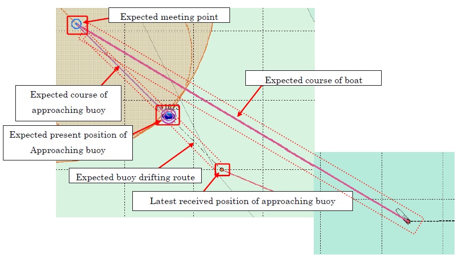
Displays the buoy’s current position and predicted course.
The latest position data is represented by a buoy icon, and the predicted course is displayed as a red circle.
When the buoy tracks its location information, it measures two separate points to calculate its precise speed and heading.
As a result, an extremely accurate forecast of its current location and course is enabled.
Additionally, the scale will display the predicted path from the current location for up to 12 hours, at 1-hour intervals.
In this system, the process from buoy deployment to retrieval is managed as a single cycle.
The tracks and history of the buoy can be delimited and analyzed by specific periods.
Specifications
Product Catalog
(Satellite Buoy)